
Résultats de recherche
7 résultats trouvés avec une recherche vide
- Tactical and strategical training through simulation
Used by : FRANCE To face the risks of its territory, France has defined a national strategy and a unicity of training. That is to say that the employment regulations are formalized at the central level and that all firefighters refer to them. The Civil Security Application School, an establishment within the Entente Valabre, offers to all French departments, a training for the officers in charge of fighting forest fires. To do so, Valabre decided to equip itself with a simulator that has placed it at the forefront of training centers. The objectives of using the simulator are multiple. First of all, it allows to offer a single training model. All firefighters become interoperable and can be integrated into reinforcement modules. They have the same decision support and operational management tools. Then, the simulator allows to reduce costs drastically no more trucks and personnel for training maneuvers. Finally, it allows the development of operational procedures: visualization of the propagation, visualization of the stakes and the alea. Thanks to its flexibility and ease of use, the trainees are confronted with a forest fire fighting situation as many times as necessary to assimilate the essential know-how in theaters of operations: development of a tactic adapted to the situation and the environment, management of human and technical means of fighting, repetition of safety measures, ... In the course of a day, the trainees are confronted with a large number of professional situations. Finally, this modern tool can be delocalized and support training in remote departments or foreign countries. It simply requires computers, an internet connection and adapted trainers. Link
- Natural indicators on ground operations
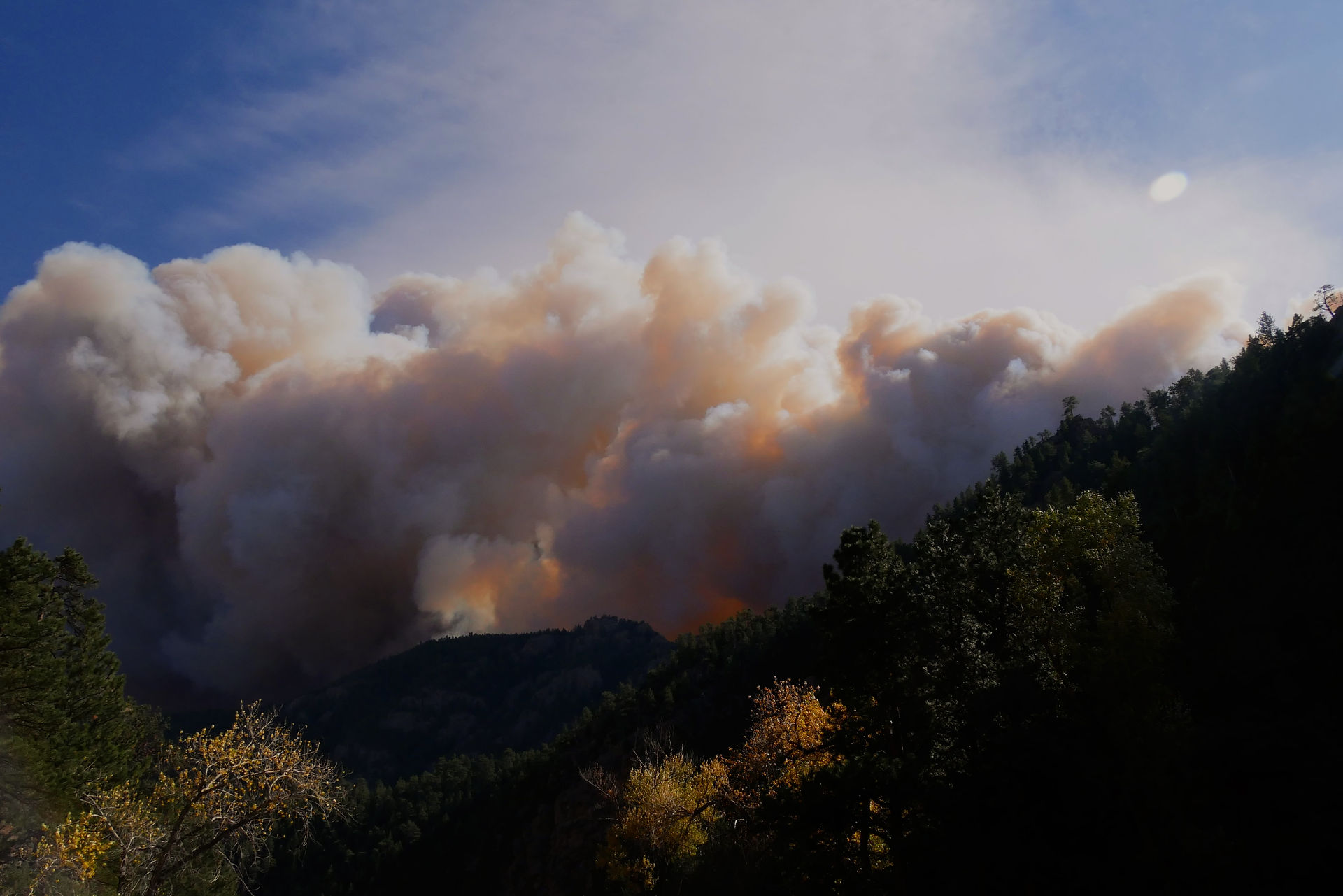
It exists some natural caracteristics that enable to identify natural indicators about the dryness or weather conditions without technical tools. Soil desiccation is one natural indicator of the leak of water in the soil. The deeper the drought, the more important this marker is visible. In addition of the leak of water available for the plants, the soil increase in temperature leading the fire to cause severe damage in depth. If rain comes, the soil could be washed away and get eroded. Dust is a clear vision of the dryness of the soil. The more important the drought is, and the more dust will be put in the air after a vehicle, person, animal passage. Water withdrawal is a critical indicator of severe drought. It indicates that evaporation rate is superior to rainfall witch can lead, it the water resource is not managed, to hydrological crisis. The touch and cracking of the surface bedding indicates the dryness of the fine fuel, the one that will ignite first in case of a fire. The more dry is the material, the more it cracks under pressure. If you hear crackling under your shoes while walking in the forest, it might give you a clear indice that the material you are walking on is ready to burn. Of course, this litter fuel is more receptive to meteorological changez (humidity, rainfall) and can also charge rapidly in humidity as well as dry out fast. The russeting of pine needles as well as the wilting of the leaves indicate a state of slowing down of the tree's biological system. This may be due to the climate, with long periods of drought, or to insect or parasite attacks. Each species has a different response to these stresses, so it is important that you can visually determine what these signs mean. You don't have a device to know the wind direction. No problem, use a rubalise and point it north. The wind will guide you.This can help on the field. Clouds are natural indicators of the stability of the atmoshpere. Cumulus can indicate you unstable air while cirrus cloud, stable air. The more the clouds grow and tend to get higher, the more unstable the air mass is, which can lead to loss of fire control. Beaufort scale can also give you some visual details to estimate the wind force and anticipate consequences on the ground if a fire breaks out. Link
- Campbell Prediction System
Campbell prediction system (CPS) is used to determine fire behavior strategies and tactics. It is about using fire behaviour observation to predict and anticipate danger points, opportunities for firefighting and threshold of control. CPS is used by most of the fireprone countries and can be coupled with polygon method. You can find more informations and ressources in http://cps.emxsys.com/
- Weather mobile measurement tools
It exists different category of tools to measure weather conditions on the ground during a fire. Rugged weather meter It is the most used by fire analysts on the ground. It gives precise data close to where the fire is occuring. Like a little and mobile weather station, it gives the wind speed, temperature, humidity and a lot of further information depending on the tool that you use. The most common rugged weather meter used is from Kestrel but you can find other brands on the market. Another tool used on the ground is weather station directly set on the command post or on an analyst vehicule. Such vehicle permit to be mobile and have immediate weather intelligence on the incident. The following picture is an example of the lesson learn vehicle in the French Eastern Pyrenees that carry out observations on the command post and its management of the situation. Less common, we find psycho-meter. The psycho-meter basically consist of two thermometers -a ‘dry bulb’ and a wet bulb’ – over which air passes at a certain speed. The results are read into a psychometric chart that gives the humidity and the temperature of the air.
- Operational cartography
Used by : most of the countries Example of cartography from Copernicus ERCC. Operational mapping is a support and decision-making tool. It helps visualizing an event in a given territory and time. The interest is to present a realistic vision of the event as well as the operation. It exists four main objectives : - to give the event information in space and time - to show all the information that promotes decision-making - to show the evolutive data such as fire perimeter or stakes - to point out the possible response scenarios. Example of use : FRANCE In France, operational fire cartography are based on several layers from "défense de la forêt contre l'incendie DFCI", translated by forest fire defense. The entire territory is mesh by coordinates. You can see them in : https://www.geoportail.gouv.fr/donnees/carroyage-dfci Map are created by Valabre and the National Institute of Geographic and Forest Information and allows the superposition of many layers such as forest access roads, water points, cities perimeters, campings, critical infrastructure etc. The operational cartography is used either with paper, either on digital format and updated by a firefighter officer, in charge of anticipation of the incident. ITALIA In Italia, the operational cartography depends on the region you are in. To take the example of Tuscany region forest fires organization, maps are generated by DREAm ITALIA at the request of Tuscany Region. Informations such as roads, structures, fuel breaks, water points, topography, vegetation groups are displayed on a 1/25 000 scale map and available on paper as in numerical format. The only difference between the two is that the digital format allows you to measure distances and areas in a more interactive way. However, fire analyst prefer to work on numerical format as they can draw the fire perimeter and annotate needed information on the ground. During the incident, the map is updated by the incident commander itself and his team within the incident command post. SOUTH WALES FIRE AND RESCUE SERVICE Digital maps allow to better analysis the terrain where the fire is moving. Also, they are useful to decide strategies (access roads, anchors, etc) and trigger points as well as opportunities.
- WebGis FIRE DANGER MAP
Used by : Most of the countries It exists different types of fire danger map, each depending on the scale, the calculation and expertise of the region where this tool is implemented. This article is focusing on examples of countries, part of the AFAN consortium, that use international, national or local FIRE DANGER MAP. The aim of the tool is to anticipate fire conditions and prepare command centers to deal with potential tense situation. FRANCE - Used by french firefighters In France, fire danger map are calculated by MeteoFrance, a french national institute that predicts weather over the country. Each day during the fire season, zonal forecasters produce two bulletins destinated to zonal operational centers, fire command centers and prefectures. Thus, firefighters can prepositionned their forces to better mesh territories that are at risk. The map is then simplify according to the wish of every prefectures and communicated to the general public. It exists 7 zonal delimitation in France for civil security. Only the south is forecasting fire danger but because of climate change, MeteoFrance is thinking to extend this forecast to the entire country. Here is an example of fire danger map that is produced for South of France by MeteoFrance. This synthesic map is realized thanks to the expertise of forecasters that takes into consideration wheather and drought parameters, as well as previous fire development in the region. This map and all other data concerning fire are not available publicly and need a login. They can be compared in space and time with weather forecast lessons learned on the biggest incident, and are only available during the fire season. Contact : https://meteofrance.com/contact ITALIA - Used by DREAM Fire danger map in Italia are regional. In Toscany region forest fires organization (and consrzio Lamma) is in charge to forecast fire danger. On a private page, not accessible from the public, data can be visualized on a map. This interactive map shows fire danger index among all the counties. The website offers the possibility to compare those index between different years. This forecast enable to prepositioned forces on the ground in the most dangerous area in prevently. Outside the fire season, it helps for prescribed burn. This fire danger risk is translated through a simplify map for general public.
- SANDBANK
Used by : DREAM (Italy) The sandbank favours visual contact and modifies the perspective with which forest fire-fighters operators, at every level, approach the observation of fire behaviour, designing a learning environment that favours the assimilation of notions. It existe different types of sandbank : - Playful with miniatures, simulating the location of machines and stakes. - Virtual, using an overhead projector to simulate the spread of fire over the terrain. Depending on the software used, it is possible to position machines virtually or via miniatures. In the field, by carrying out a briefing, the coordinator can draw the situation on the ground. In all cases, the sandbox is intended to be educational in order to better represent the situation. The tool can be molded as desired. Example of use : In Toscani (Italy), DREAM is using sandbanck for : - lessons learned : understanding fire behavior and fire spread patterns - for simulating scenarios and doing exercises during training sessions


